High Pressure Takes Charge But Who Gets The Most Sun?
This week looks mostly free of significant weather as a high pressure system sits below the country but extends north covering the entire country by Tuesday. The low sitting over the Chatham Islands will decrease in size as the week goes on, bringing back warmer temperatures for parts of the east coast of both islands. Temperatures across the central and northern regions of the North Island will remain in the mid 20’s. The high then begins to decrease in size from late Thursday as a low moves down towards Northland from the northwest.
We are currently monitoring this low as it develops off the Queensland coast during the early stages of the week. Current model data has indicated that subtropical moisture could get sucked into the low which could result in potential heavy rain risks being issued later in the week. There is also uncertainty of where the low will go. Latest model data has given us a variation of possible outcomes, keep a look out for updates during the week!
Continue reading for the sunshine forecast.

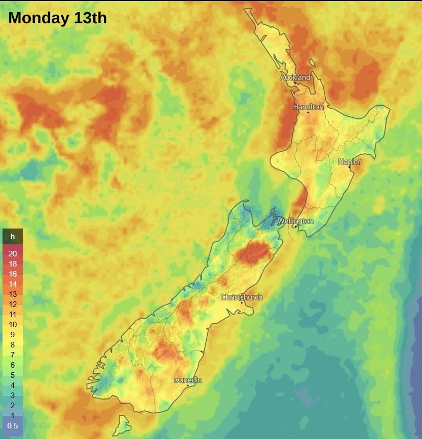
With the high in charge this week you can expect sunshine along with settled conditions, yay! As mention above the low to the east of the country along with a southerly airflow has kept temperatures lower than average and brought cloudy conditions.
This week expect those conditions to improve if you live on the east coast especially towards the middle and end of the week. Southern regions of the South Island and remaining regions in the North Island have continued fine spells.
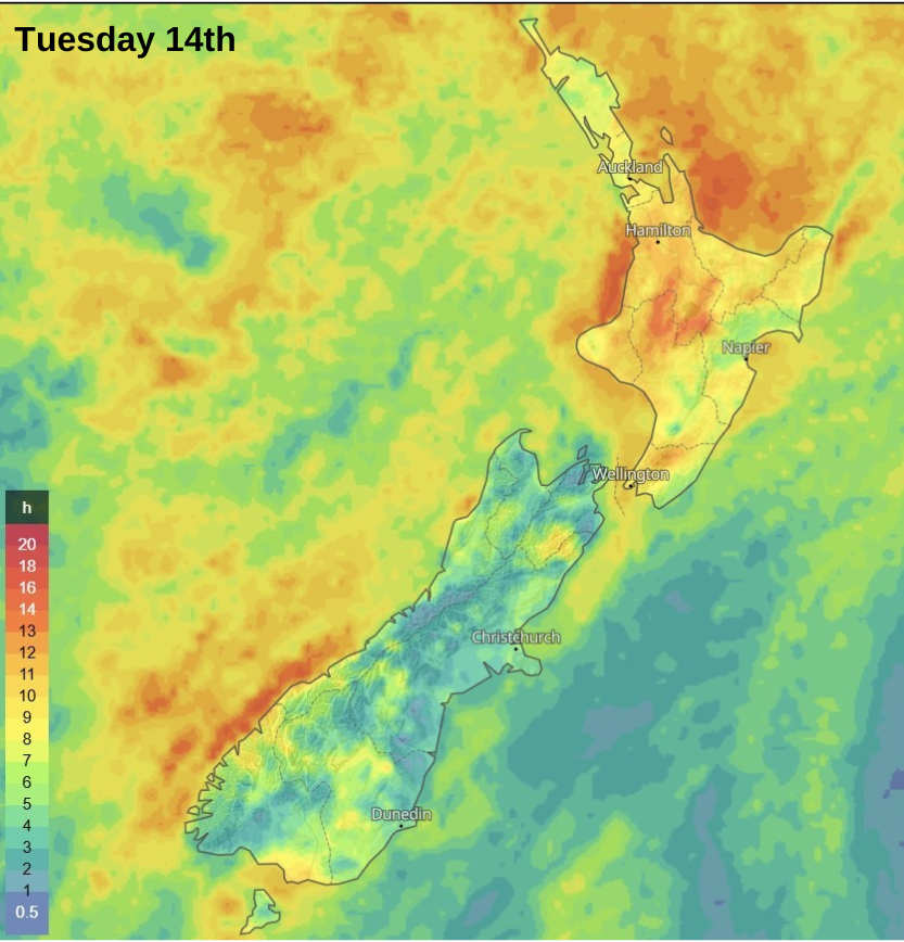
Note that with the uncertainty of the incoming low please take caution when observing the sunshine hours map for Thursday, Friday and Saturday as the current forecast could increase or decrease sunshine hours especially for the northern and western regions of the North Island.
Colours on the map correspond to the number of hours of sunshine, see the key on the map.
Keep checking our Significant Weather page each day for more detailed forecasts.